Video: 00:04:30
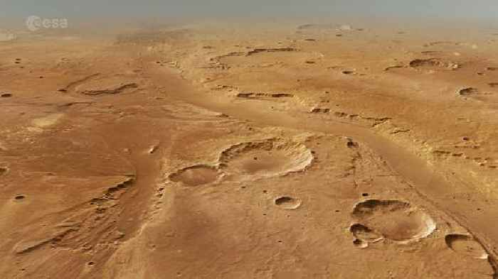
Explore the immense power of water as ESA’s Mars Express takes us on a flight over curving channels, streamlined islands and muddled ‘chaotic terrain’ on Mars, soaking up rover landing sites along the way.
This beautiful flight around the Oxia Palus region of Mars covers a total area of approximately 890 000 km2, more than twice the size of Germany. Central to the tour is one of Mars’s largest outflow channels, Ares Vallis. It stretches for more than 1700 km2 and cascades down from the planet’s southern highlands to enter the lower-lying plains of Chryse Planitia.
Billions of years ago, water surged through Ares Vallis, neighbouring Tiu Vallis, and numerous other smaller channels, creating many of the features observed in this region today.
*Enjoy the flight!*
After enjoying a spectacular global view of Mars we focus in on the area marked by the white rectangle. Our flight starts over the landing site of NASA’s Pathfinder mission, whose Sojourner rover explored the floodplains of Ares Vallis for 12 weeks in 1997.
Continuing to the south, we pass over two large craters named Masursky and Sagan. The partially eroded crater rim of Masursky in particular suggests that water once flowed through it, from nearby Tiu Vallis.
The Masurky Crater is filled with jumbled blocks, and you can see many more as we turn north to Hydaspis Chaos. This ‘chaotic terrain’ is typical of regions influenced by massive outflow channels. Its distinctive muddled appearance is thought to arise when subsurface water is suddenly released from underground to the surface. The resulting loss of support from below causes the surface to slump and break into blocks of various sizes and shapes.
Just beyond this chaotic array of blocks is Galilaei crater, which has a highly eroded rim and a gorge carved between the crater and neighbouring channel. It is likely that the crater once contained a lake, which flooded out into the surroundings. Continuing on, we see streamlined islands and terraced river banks, the teardrop-shaped island ‘tails’ pointing in the downstream direction of the water flow at the time.
Crossing over Ares Vallis again, the flight brings us to the smoother terrain of Oxia Planum and the planned landing site for ESA’s ExoMars Rosalind Franklin rover. The primary goal of the mission is to search for signs of past or present life on Mars, and as such, this once water-flooded region is an ideal location.
Zooming out, the flight ends with a stunning bird’s-eye view of Ares Vallis and its fascinating water-enriched neighbourhood.
Disclaimer: This video is not representative of how Mars Express flies over the surface of Mars. See processing notes below.
*How the movie was made*
This film was created using the Mars Express High Resolution Stereo Camera Mars Chart (HMC30) data, an image mosaic made from single orbit observations of the High Resolution Stereo Camera (HRSC). The mosaic, centred at 12°N/330°E, is combined with topography information from the digital terrain model to generate a three-dimensional landscape.
For every second of the movie, 50 separate frames are rendered following a predefined camera path in the scene. A three-fold vertical exaggeration has been applied. Atmospheric effects such as clouds and haze have been added to conceal the limits of the terrain model. The haze starts building up at a distance of 300 km.
The HRSC camera on Mars Express is operated by the German Aerospace Center (DLR). The systematic processing of the camera data took place at the DLR Institute for Planetary Research in Berlin-Adlershof. The working group of Planetary Science and Remote Sensing at Freie Universität Berlin used the data to create the film.
Fly around Ares Vallis on Mars
ESA
0 shares
2 views


