U.K. Edition
Saturday, 26 April 2025

Land's End to John o' Groats

Traversal of the length of Great Britain


Land's End to John o' Groats

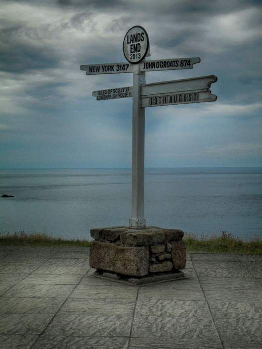
Land's End to John o' Groats is the traversal of the length of the island of Great Britain between two extremities, in the southwest and northeast. The traditional distance by road is 874 miles (1,407 km) and takes most cyclists 10 to 14 days; the record for running the route is nine days. Off-road walkers typically walk about 1,200 miles (1,900 km) and take two or three months for the expedition. Signposts indicate the traditional distance at each end.

  • Land's End is the traditionally acknowledged extreme western point of mainland England. It is in western Cornwall at the end of the Penwith peninsula. The O. S. Grid reference of the road end is SW342250, Postcode TR19 7AA. In fact it, or strictly speaking Dr Syntax's Head, SW341253, a few hundred yards NW of the road end, is mainland England's most westerly point. The most southerly point is Lizard Point, about 9 miles (14 km) further south. Land's End is sometimes reckoned incorrectly as mainland Great Britain's most southwesterly point. This accolade belongs to Gwennap Head, SW365215, which is at least 2 miles (3.2 km) further south than Dr Syntax's Head but only about 1.5 miles (2.4 km) less west.
  • John o' Groats is the traditionally acknowledged extreme northern point of mainland Scotland, in northeastern Caithness, O.S. Grid Reference ND380735, Postcode KW1 4YR. The actual northernmost point is Dunnet Head about 2 miles (3 km) further north. The point that is farthest by road from Land's End is Duncansby Head, about 2 miles (3 km) east of John o' Groats. Duncansby Head is also the most northeasterly point of the British mainland.
0 shares 1 views

News coverage

You might like